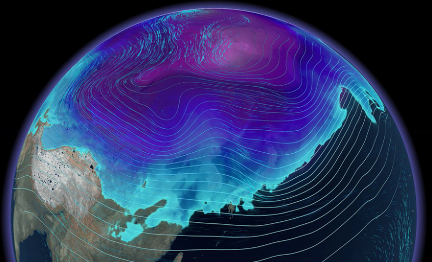
A significant disruption of atmospheric patterns around the Arctic is expected to begin any day, potentially allowing cold air to infiltrate farther south into parts of the Northern Hemisphere.
The event, known as sudden stratospheric warming, occurs when temperatures - typically miles above Earth's surface - rise dramatically over a short period, often by more than 30 degrees Fahrenheit.
This sudden warming can disturb the polar vortex, a large area of low pressure and cold air that normally circulates around the Arctic.
When the vortex is disrupted, it can stretch, weaken or even split, reducing the bottling mechanism that normally traps cold air - allowing the airmass to spill into the warmer midlatitude regions, where most of the world's population lives.
Such events are not unusual, but when a sudden stratospheric warming coincides with other oscillations, it can grab headlines because of its extreme potential, creating opportunities for deep cold, snow and other wintry weather across parts of North America, Europe and Asia.
Forecast models have shown a sharp rise in stratospheric temperatures over the coming weeks across the Arctic Circle - one that could venture being historic because of its intensity.

However, forecasters caution that a temperature spike in the upper atmosphere does not automatically translate into cold weather impacting everyone around the globe.
A key variable are the high-altitude winds that make up the polar vortex.
During some events, the vortex may bulge toward Asia, leading to colder-than-average conditions there while leaving North America relatively mild.
Conversely, a displacement over North America can unleash an Arctic airmass across the United States and parts of Europe, leaving Asia on the warmer side.
The disruption of the polar vortex following the sudden stratospheric warming can take weeks to play out and be difficult for long-term forecast models to correctly depict.

Other atmospheric fluctuations such as the El Niño-Southern Oscillation, the Madden-Julian Oscillation and the North Atlantic Oscillation can influence the position of the jet stream and the distribution of cold air.
The potential overlap of these signals in the coming weeks has forecasters watching closely to determine how meteorological winter will begin.
Will it start off cold and snowy, or will it follow a milder, "blowtorch" pattern?
Recent Decembers haven't been too kind to Old Man Winter. The last time the U.S. finished a December with below-average temperatures was in 2013, and according to NOAA data, all four of the warmest Decembers on record have occurred within the past decade.
For now, much of the U.S. is expected to experience above-average temperatures as Thanksgiving week approaches. A strong ridge of high pressure is forecast to dominate much of the southern half of the country, keeping the storm track displaced to the north.

Temperatures could run up to 15 degrees above average, particularly across the South between the I-20 and I-10 corridors, which will set daily records.
The Southeast's next round of chilly weather is likely to come after Thanksgiving with meteorologists monitoring models such as the Global Forecast System (GFS) and the European Centre for Medium-Range Weather Forecasts (ECMWF) to determine when winter will make its return.
Copyright 2025 Storm Center


