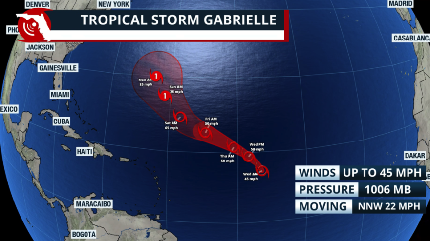
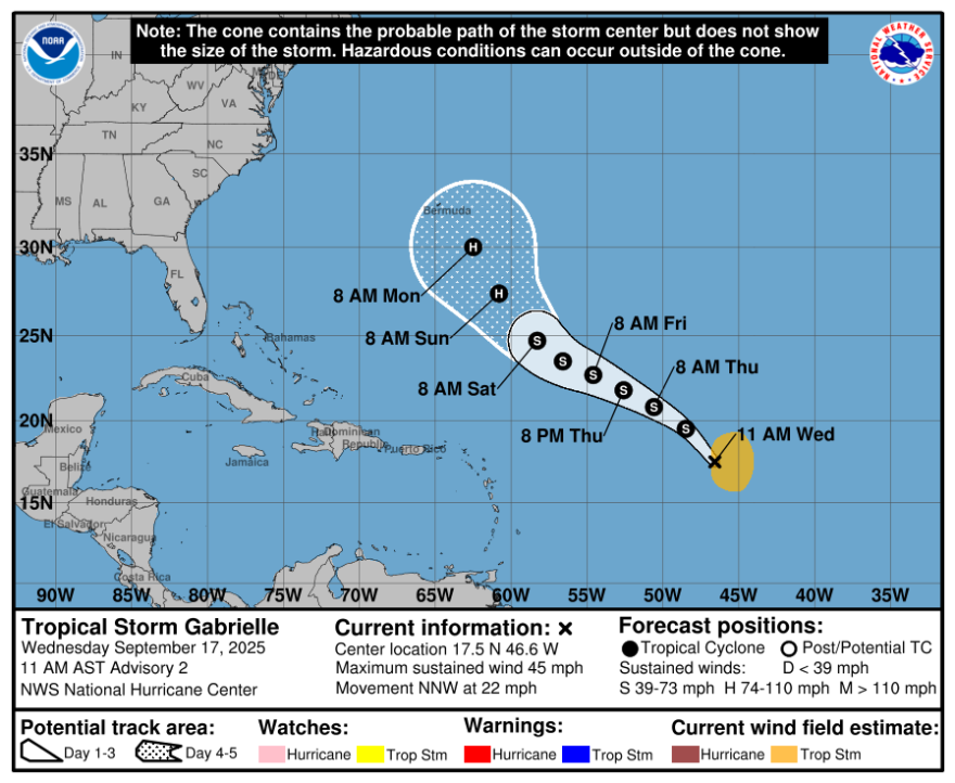
The National Hurricane Center has officially named the seventh storm of the season, Gabrielle. The tropical storm will stay over the central tropical Atlantic through the end of the week. It will also stay away from the U.S. East Coast.
The jet stream, displaced south, will prevent this system from turning west, toward the U.S.
At most, over the weekend, there could be high waves, surf, and the risk of rip currents, but at a safe distance from the smaller Caribbean islands, so that there is no direct impact.
Bermuda, on the other hand, should monitor this system closely, as it could have a chance to come close next week. As of now, it is too soon to know how close it could be to Bermuda. What we can say is that this system does not have a chance to impact the Southeast, including Florida.


Depending on when it makes the northward turn, there could be rough seas along the Florida east coast, but this will also depend on whether the system expands its wind field as it travels north. Nevertheless, this would be the only indirect impact on Florida resulting from this system.
Another tropical disturbance follows
There is not much to report about the next tropical wave that has just emerged from Africa. It is over 3,000 miles away, and very disorganized in its infancy stages. Long-range models hint that it will follow Invest 92L's track, but others don't show any further development.
Nevertheless, it is far too soon to discuss what this system could become. We will continue to provide you with updates as these disturbances develop.
Short term: worries from deep moisture in place
Florida, specifically South Florida, should closely monitor the heavy rains that will impact the region between Wednesday and Friday. A flash flood risk will be in effect at least until Friday, as rainfall is expected to range from 2 to 4 inches across major metropolitan areas in Miami-Dade, Broward, and Palm Beach, with some isolated spots receiving over 6 inches. Please stay away from flooded roads.
Copyright 2025 Storm Center


