
Beneficial rain will continue to impact Florida’s Panhandle and North Florida throughout the weekend.

A cold front is gradually weakening as it pushes southward across the state. Even so, the front will bring numerous showers and the chance for an isolated severe thunderstorm on Saturday, especially along the Interstate 10 corridor. Showers and thunderstorms will move intermittently from west to east across the region throughout the day.
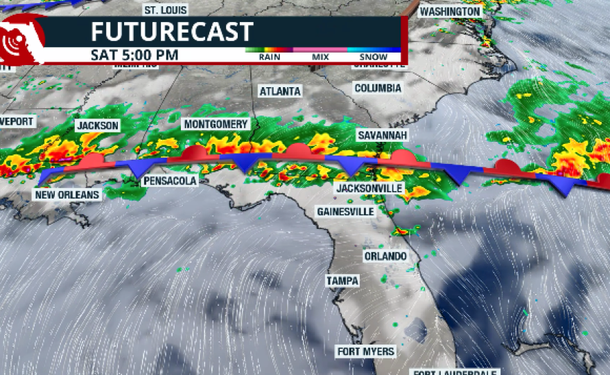


On Sunday, the front stays meandering nearby, slowly inching closer to Central Florida. This will allow isolated thunderstorms to develop along the northern fringe of Central Florida, while showers and thunderstorms continue to impact much of the Panhandle and North Florida. Periods of rain and storms are expected on and off through the day. Any thunderstorms that become severe could produce isolated tornadoes, small hail, and damaging wind gusts of at least 58 mph.

Rainfall totals across the region could range from 3 to 5 inches through the weekend. These totals will be beneficial for North Florida and the Panhandle, where drought conditions remain in the extreme-to-exceptional category.

However, it is important to keep in mind that parts of the western Panhandle, including the Tallahassee area, have already received rainfall over the past several days. Because of this, any heavier downpours that repeatedly move over the same locations, or storms capable of producing high rainfall rates in a short period, could lead to localized flooding.


