
There is an extreme cold watch in effect for the entire Panhandle, North, and much of Central Florida through Lake Okeechobee. An extreme cold watch means dangerously cold wind chills in the teens for most of North Florida and in the single digits across the state

WHAT IS WIND CHILL? It combines air temperature and wind speed to estimate how quickly heat is removed from exposed skin. Stronger wind speeds make you lose heat faster, so the body feels colder than the actual thermometer reading. This is not what the thermometer shows, but what it feels like, accounting for the wind.
We have a quite combination of features heading to Florida. First, a low-pressure system coming in from the Gulf, which will dissect the state from west to east across central Florida. This component is responsible for delivering moisture.
From the north, and in the upper levels of the atmosphere, a low-pressure system, or trough, is part of the polar vortex that will break off and travel south enough to impact the entire eastern seaboard.


For Florida, the timing of the two will be crucial to the chance of snow, which, if any, would be in the Tampa Bay area. We do not expect accumulations to pile up on the floor; most of it, if any, will melt before it hits the floor.
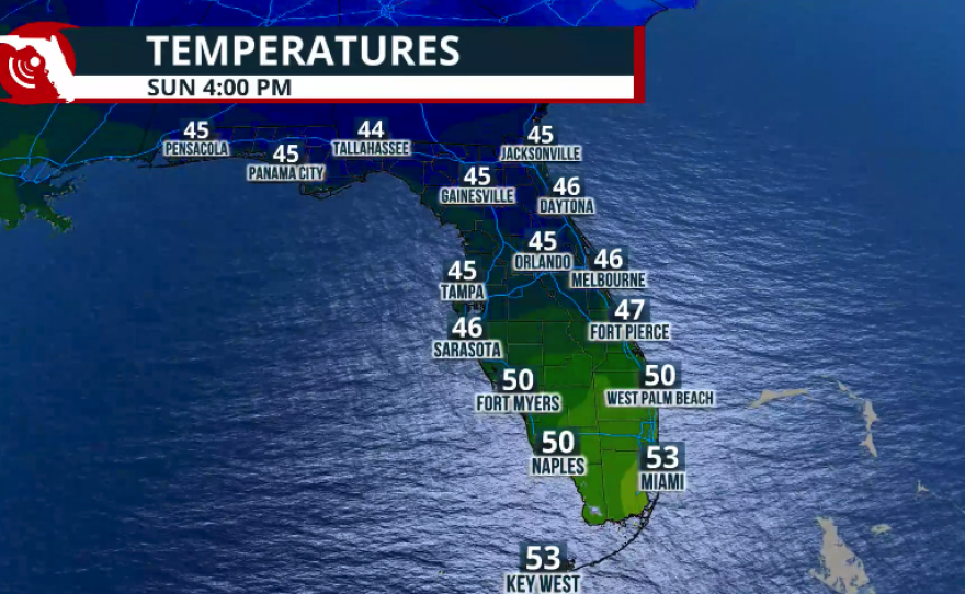
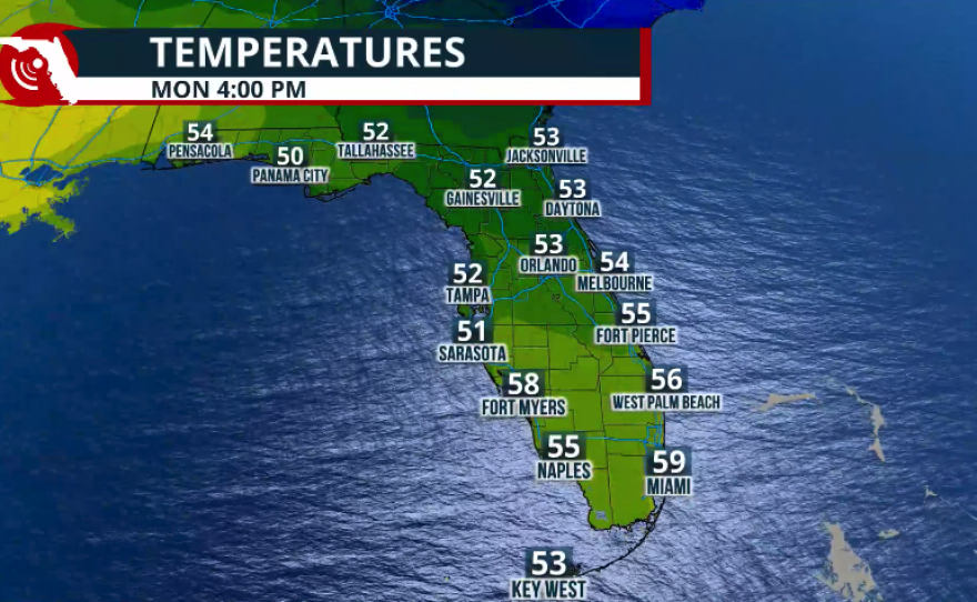
What I want you to pay close attention to is the dangerously cold temperatures that will take over the state starting this weekend and continuing through Sunday.


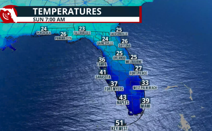
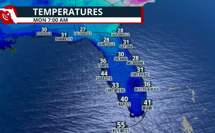
Temperatures will already be cold, but the wind will make it feel brutally colder. For the Panhandle, lows on Sunday, plus the wind, will feel like the teens. North Florida will feel like the 20s, Central Florida in the low to mid 20s, and South Florida in the upper 20s. This is why an extreme cold watch is in effect — it will likely be upgraded to a warning tomorrow, Friday.
Copyright 2026 Storm Center


