A powerful cold front sweeping across the Sunshine State this weekend is going to create the specific weather conditions conducive to wildfires in the northern Panhandle and western Peninsula including Southwest Florida.
Instead of typical winter warmth, this arctic blast will push very dry, cold air across Florida during the weekend.
Temperatures will drop from the 80s Saturday to the 60s and 70s Sunday, then into the 30s and 40s Monday morning.
Here's what's driving the danger: an unusual arctic cold front coupled with severe drought conditions throughout the state. Winds will gust up to 30 miles per hour behind the cold front. Relative humidity will drop as low as 15 percent in some areas. That's bone dry.
Such low humidity can pull the moisture out of previously sated vegetation, drying it out to become wildfire fuel.
“Any fire that develops will catch and spread quickly,” NWS forecasters wrote. “Outdoor burning is not recommended.”
The timing makes it worse. Florida is already experiencing severe drought conditions in many areas. Dead vegetation and dry grass become tinderboxes when combined with strong winds and desert-like humidity.
The urgent warnings about wildfires breaking out throughout the north and northeastern portions of Florida Saturday will shift south to the Tampa Bay region Sunday, and into Southwest Florida Monday.
The National Weather Service in Tampa Bay Ruskin has issued a Fire Weather Watch starting early Monday and lasting through Monday evening for counties including Lee, Charlotte, Sarasota, Manatee, Hardee, Highlands, and DeSoto
Winds are forecast to be from the northwest from 10 to 15 miles per hour gusts up to 25. The humidity is expected to be as 21 percent – the Mojave Desert on a typical day. Any fire that starts during these periods will spread rapidly and become difficult to contain.
The NWS has issued a Fire Weather Warning on Sunday afternoon around Tampa Bay.due to low humidity, breezy northerly winds, and moderate-to-significant wildfire potential.
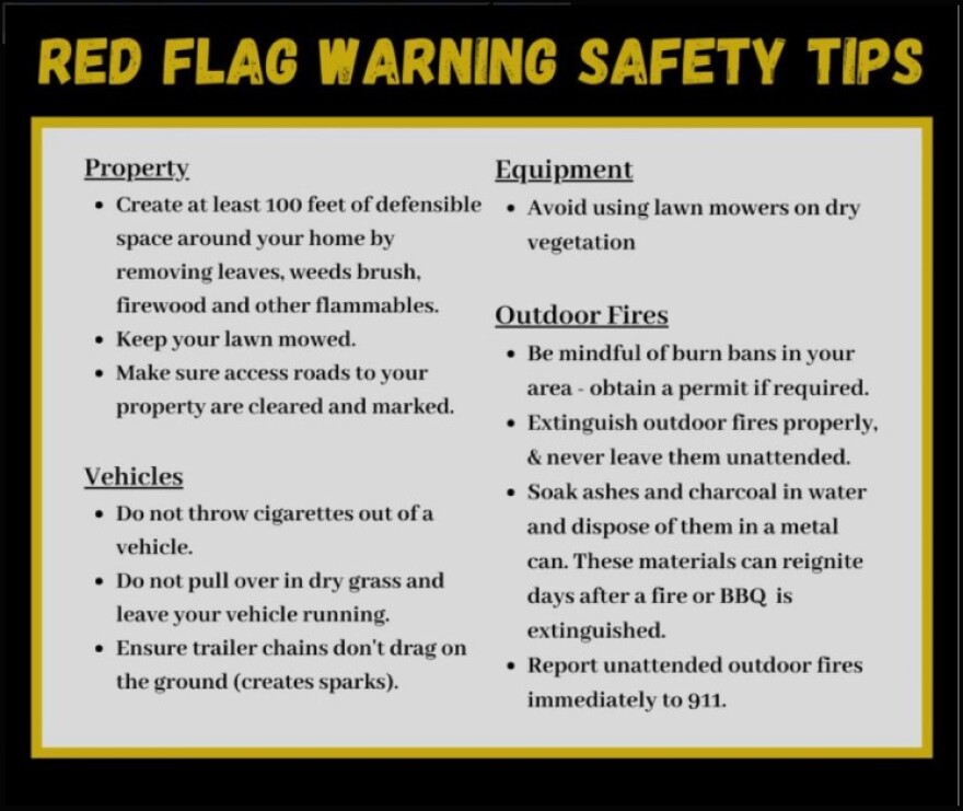
A Red Flag Warning means that critical fire weather conditions are either occurring, or will shortly. That combination of strong winds, low relative humidity, and dry fuels can contribute to extreme fire behavior.
A Fire Weather Watch means that critical fire weather conditions are forecast to occur. Listen to broadcasts of later forecasts for possible Red Flag Warnings.
The National Weather Service in Tallahassee and Jacksonville issued the first alerts Saturday as an arctic blast pushes southeast across the state. A Red Flag Warning is forecast Sunday afternoon from 1 to 7 p.m. for much of North Florida, including Flagler and portions of Volusia counties.
Officials urge residents to postpone any outdoor burning, avoid activities that could create sparks, and clear dry debris from around homes and buildings.

Environmental reporting for WGCU is funded in part by VoLo Foundation, a non-profit with a mission to accelerate change and global impact by supporting science-based climate solutions, enhancing education, and improving health.
Sign up for WGCU's monthly environmental newsletter, the Green Flash, today.WGCU is your trusted source for news and information in Southwest Florida.
We are a nonprofit public service, and your support is more critical than ever. Keep public media strong and donate now. Thank you. WGCU is your trusted source for news and information in Southwest Florida. We are a nonprofit public service, and your support is more critical than ever. Keep public media strong and donate now. Thank you.


