
A cold front is trying to approach the western Florida Panhandle and will increase the chance for some showers on Sunday, along with the possibility of a few isolated thunderstorms. Meanwhile, the western half of the peninsula, from the I-4 corridor westward through Southwest Florida, will continue to have the best chance of showers and thunderstorms during the afternoon, even through the beginning of next week. The eastern half of the peninsula will remain partly sunny with only a low chance of a stray afternoon shower.
The chance for showers and some storms across the Panhandle as a front tries to get close. It will retract north.
— Florida Public Radio Emergency Network (FPREN) (@FloridaStorms) March 8, 2026
The heat and east winds will continue strong across the Panhandle. pic.twitter.com/8tFhDUkjqk
The difference between a wetter West Coast and a drier East Coast comes down to the winds. Winds will continue to be strong at times, coming in from the Atlantic. This will enhance shower and thunderstorm activity across the western half of the peninsula as moisture moves inland, warms, and becomes more unstable.
The east winds will also bring rip current risk along Florida's East Coast. A trip to the beach will be tempting; make sure to swim near a lifeguard.

Across North Florida and the Panhandle, the cold front will only attempt to approach before retracting to the north and dissipating. A high-pressure system will take over on Monday, limiting rain chances across the area. Nonetheless, we could see partly sunny skies on Monday afternoon with a low chance of a stray shower across northeastern Florida.
The next chance for a front to move through the state will come toward the end of the week. However, we are not expecting this next front to bring cold weather, as a high-pressure system will be centered over the Mid-Atlantic. This will keep winds mainly from the east across the Sunshine State. At most, we may see a brief push of slightly drier and cooler air moving through the state, but it will only last a short time.
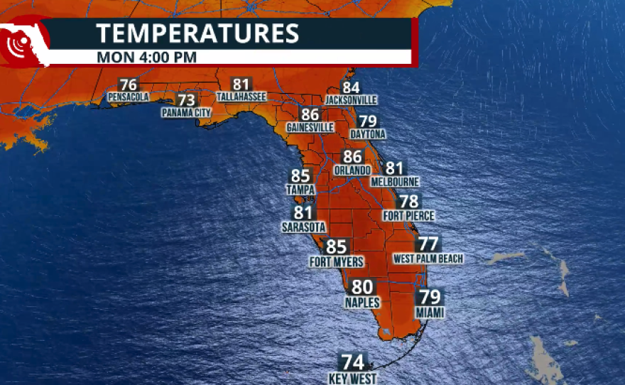
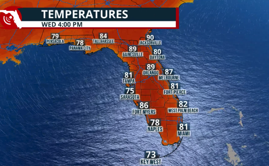
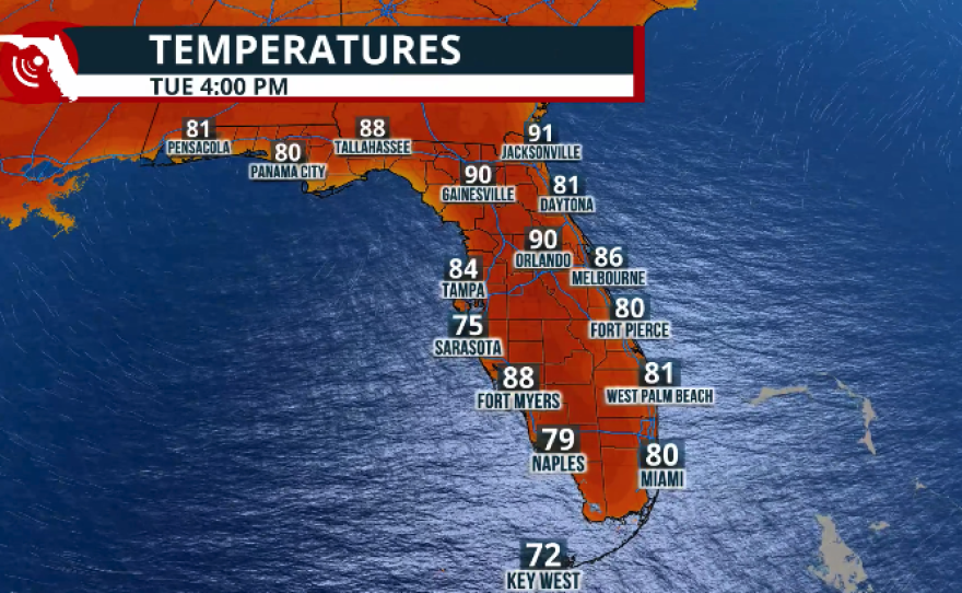
Temperatures will remain toasty for much of the week. With high pressure in place, expect highs near 90° across the Panhandle and North Florida, while Central and South Florida, including the Keys, will stay in the low to mid-80s.
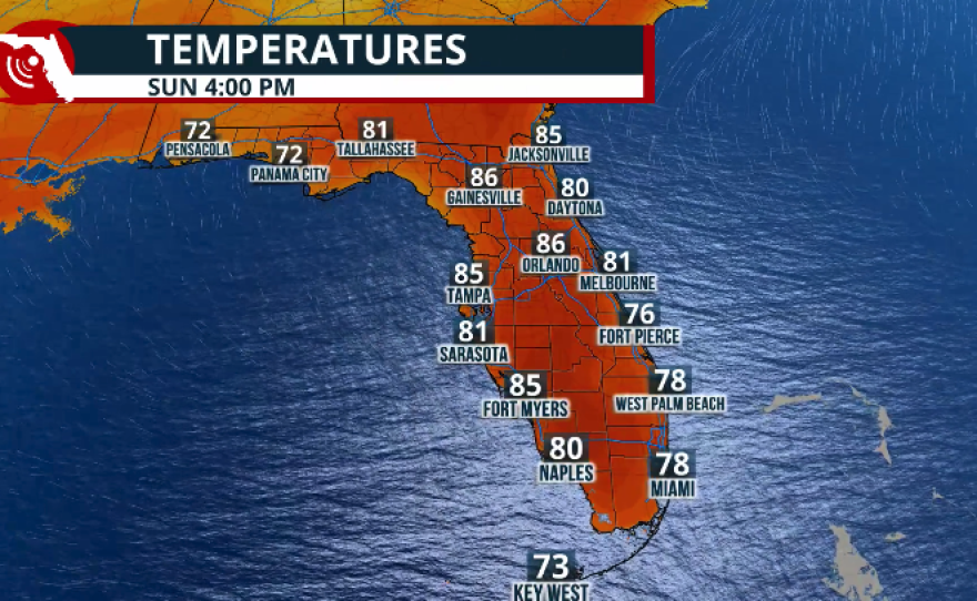
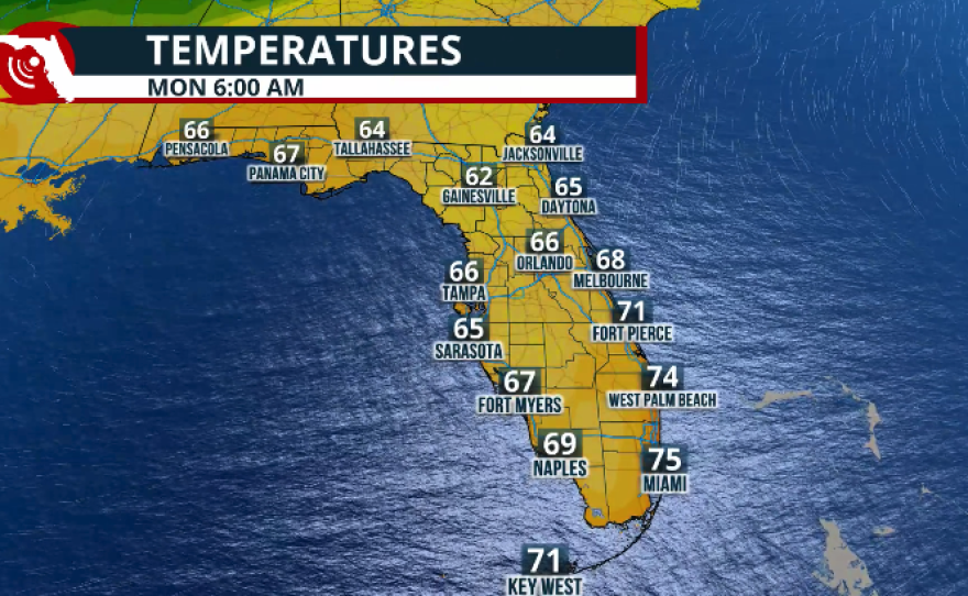
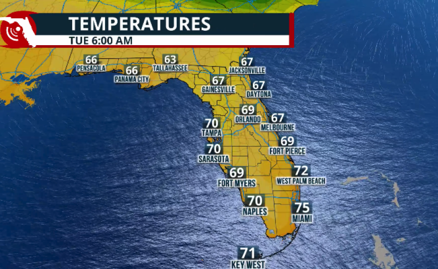
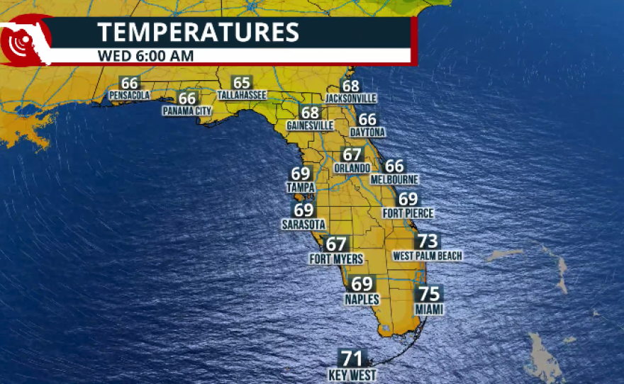
Mornings will remain muggy and warm, with low temperatures staying about 5 to 10 degrees above normal for this time of year. Lows across the Panhandle will be in the low to mid-60s, while Central and South Florida will range between 67 and 71 degrees.
A slight decrease in temperatures is possible next Saturday, but as mentioned, it will likely be short-lived.


